Monday, October 13, 2014

Lewis and Clark


Lewis and Clark, or the Corps of Discovery went out on a mission to map out routes to the Pacific Ocean, to report and document, plants and animals along the journey. They made map of their journey, and were set out to explore the west and document it also.

Image: Map marking the paths Lewis and Clark took from Saint Louis to Fort Clatsop and back
Map of Lewis and Clark


3 Journal Entries

View of the Missouri River and levee
Clark, September 29 1804

It was at the mouth of River Kansies.
They were on the north side, and they saw indians across the river on the south shore. They are talking about what the saw, on the way to get what the needed at the time it was tobacco.


Grizzly bear tracks on a muddy shore             

At the mouth of a river Lewis and Clark came accross tracks of white bear footprints, which were known to be very large, and enormous. Clark followed the footprints up the river mile.  


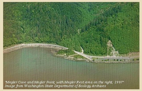
Megler Cove and Megler Point, 1997                                                


Clark, November 15th 1805

After harsh weather, it finally became fair, and cleared up, they were set out to find there baggage. The sun was shining til about 1 o'clock. From the southeast, they remailed at Megler Cove.


No comments:

Post a Comment